
Clement-Jones family - Person Sheet
Clement-Jones family - Person Sheet
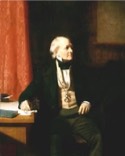
NameRear Admiral Sir Francis BEAUFORT KCB, FRS, FRGS  , 9713
, 9713Birth1774
Death1857
FatherDaniel Augustus BEAUFORT , 9712 (1739-1821)
Notes for Rear Admiral Sir Francis BEAUFORT KCB, FRS, FRGS
Rear-Admiral Sir Francis Beaufort, KCB, FRS, FRGS (27 May 1774 – 17 December 1857) was an Irish hydrographer and officer in Britain's Royal Navy. Beaufort was the creator of the Beaufort scale for indicating wind force.
]Biography
Francis Beaufort was descended from the French Protestant Huguenots, who fled the French Wars of Religion in the 1500s.
Sir Francis Beaufort's father, Daniel Augustus Beaufort, was a Protestant clergyman in Navan, County Meath, Ireland, and a member of the learned Royal Irish Academy. Francis was born in Navan on 24 May 1774.[1] Since Francis was to become eminent in nautical maps, it is noteworthy that Francis's father created and published a new map of Ireland in 1792.[2] Francis grew up in Wales and Ireland until age fourteen.[3] He then left school and went to sea, but later in life had become sufficiently self-educated to associate with some of the greatest scientists and applied mathematicians of his time, including Herschel, Airy, and Babbage.
Francis Beaufort had a lifelong keen awareness of the value of accurate charts for those risking the seas, having been shipwrecked himself at age fifteen due to a faulty chart, and his life's biggest accomplishments were in nautical charting.
Beginning on a merchant ship of the British East India Company, Beaufort rose (during the Napoleonic Wars) to midshipman, lieutenant (on 10 May 1796) and commander (on 13 November 1800). He served on the fifth rate frigate HMS Aquilon during the battle of the Glorious First of June, when Aquilon rescued the dismasted HMS Defence and exchanged broadsides with the French ship-of-the line, Impetueux.
When serving on HMS Phaeton, Beaufort was badly wounded leading a cutting-out operation off Malaga in 1800 that resulted in the capture of the 14-gun polacca Calpe. While recovering, during which he received a "paltry" pension of £45 p.a., he helped his brother-in-law Richard Lovell Edgeworth to construct a semaphore line from Dublin to Galway. He spent two years at this activity, for which he would accept no remuneration.[4]
He returned to active service and became captain (on 30 May 1810) in the Royal Navy. Whereas other wartime officers sought leisurely pursuits at each opportunity,[citation needed] Beaufort spent his leisure time taking soundings and bearings, making astronomical observations to determine longitude and latitude, and measuring shorelines. His results were compiled in new charts.
The Admiralty gave Beaufort his first ship command, HMS Woolwich, and gave him the task of conducting a hydrographic survey of the Rio de la Plata estuary of South America. Experts were very impressed by the survey Beaufort brought back. Notably, Alexander Dalrymple remarked in a note to the Admiralty in March 1808, that "we have few officers (indeed I do not know one) in our Service who have half his professional knowledge and ability, and in zeal and perseverance he cannot be excelled".
Wind force scale
During these early years of command, Beaufort developed the first versions of his Wind Force Scale and Weather Notation coding, which he was to use in his journals for the remainder of his life. From the circle representing a weather station, a staff (rather like the stem of a note in musical notation) extends, with one or more half or whole barbs. For example, a stave with 3½ barbs represents Beaufort seven on the scale, decoded as 32–38 mph, or a "Fresh Gale". Beaufort didn't really invent something new here; rather, he eventually succeeded in getting others to adopt it as a standard when there was no existing standard.
In 1811–1812, shortly after reaching 'post' rank (i.e. being promoted to Captain), Beaufort charted and explored southern Anatolia, locating many classical ruins. An attack on the crew of his boat (at Ayas, near Adana), by Turks interrupted his work and gave him a serious bullet wound in the hip. He returned to England and drew up the charts himself, also publishing in 1817 his book Karamania; or a brief description of the South Coast of Asia Minor, and of the Remains of Antiquity.
In 1829, at age 55 (retirement age for most administrative contemporaries), Beaufort became the British Admiralty Hydrographer of the Navy. He remained at the post for 25 years. Beaufort converted what had been a minor chart repository into the finest surveying and charting institution in the world. Some of the excellent charts the Office produced are still in use today.
During his tenure, he took over the administration of the great astronomical observatories at Greenwich, England, and the Cape of Good Hope, Africa. Beaufort directed some of the major maritime explorations and experiments of that period. For eight years, Beaufort directed the Arctic Council during its search for the explorer, Sir John Franklin, lost in his last polar voyage to search for the legendary Northwest Passage.
As a council member of the Royal Society, the Royal Observatory, and the Royal Geographic Society (which he helped found), Beaufort used his position and prestige as a top administrator to act as a "middleman" for many scientists of his time. Beaufort represented the geographers, astronomers, oceanographers, geodesists, and meteorologists to that government agency, the Hydrographic Office, which could support their research.
Beaufort trained Robert FitzRoy, who was put in temporary command of the survey ship HMS Beagle after her previous captain committed suicide. When FitzRoy was reappointed as Commander for the famous second voyage of the Beagle he requested of Beaufort "that a well-educated and scientific gentleman be sought" as a companion on the voyage. Beaufort's enquiries led to an invitation to Charles Darwin, who later drew on his discoveries in formulating the theory of evolution he presented in his book The Origin of Species.
Overcoming many objections, Beaufort obtained government support for the Antarctic voyage of 1839–1843 by James Clark Ross for extensive measurements of terrestrial magnetism, coordinated with similar measurements in Europe and Asia. (This is comparable to the International Geophysical Year of our time.)
Beaufort promoted the development of reliable tide tables around British shores, motivating similar research for Europe and North America. Aiding his friend William Whewell, Beaufort gained the support of the Prime Minister, Duke of Wellington, in expanding record-keeping at 200 British coastguard stations. Beaufort gave enthusiastic support to his friend, the Astronomer Royal and noted mathematician George Airy in achieving a historic period of measurements by the Greenwich and Good Hope observatories. Beaufort retired from the Royal Navy with the rank of Rear-Admiral on 1 October 1846, at the age of 72.
Francis Beaufort became "Sir Francis Beaufort" on becoming a KCB (Knight Commander of the Bath) on 29 April 1848 - a relatively belated honorific considering the eminence of his position from 1829 onward.
Beaufort's extant correspondence of 200+ letters and journals contained portions written in personal cipher. Beaufort altered the Vigenère cipher, by reversing the cipher alphabet, and the resulting variant is called the Beaufort cipher. The deciphered writings revealed family and personal problems including some of a sexual nature.
He died on 17 December 1857 at age 83 in Hove, Sussex, England. He is buried in the church gardens of St John at Hackney, London, where his tomb may still be seen.
Beaufort, like other patrons of exploration, has had his name applied to many geographical places. Among these:
Beaufort Sea (arm of Arctic Ocean)
Beaufort Island, Antarctic
Beaufort Inlet, North Atlantic Ocean